Research & Speculation
Operation Desert Dijk
A conceptual, climate-adaptive urbanization strategy for Syria's Mesopotamian valley — addressing water scarcity and desertification through large-scale, fossil-free intervention.
- Year
- 2018
- Role
- Master Class Studio
- Office
- Fontys Academy of Architecture
- Domain
- Geoengineering · Regional Planning
The misleading crescent
The name “Fertile Crescent” does a lot of quiet damage. Contrary to the assumption that the region once simply had more rainfall, the evidence points to its present degradation as the result of millennia of human interference with the ecosystem — Hartmut Kühne's work on the collapse of the Assyrian empire being one of the clearer accounts of it.
Which means sustainable urban life here was never given. It has always required large-scale, organised effort, adapted to a harsh environment. Operation Desert Dijk takes that as the premise: the region already contains the elements a balanced urban environment needs, and the work is to reorganise them through deliberately planned intervention.
Three parallel strategies
First, large-scale environmental intervention — eco-engineering at geoengineering scale, to restore and then stabilise the ecosystem. Second, technological integration, as the enabler that makes transformation at this size possible within a human timeframe. Third, urban revitalisation: reconnecting Middle Eastern city fabrics and resuming a tradition of city-making that the past century interrupted.
Where the water goes
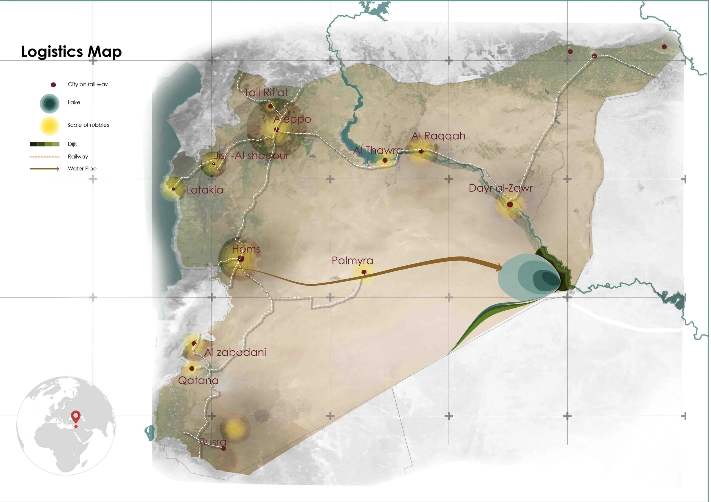
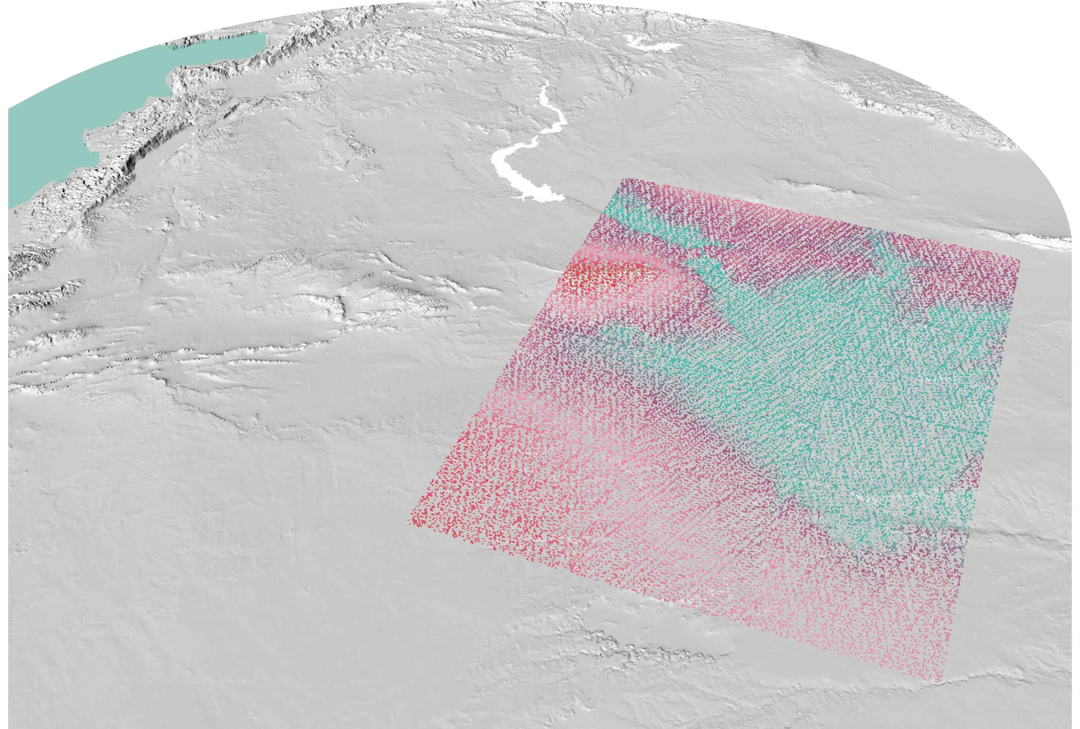
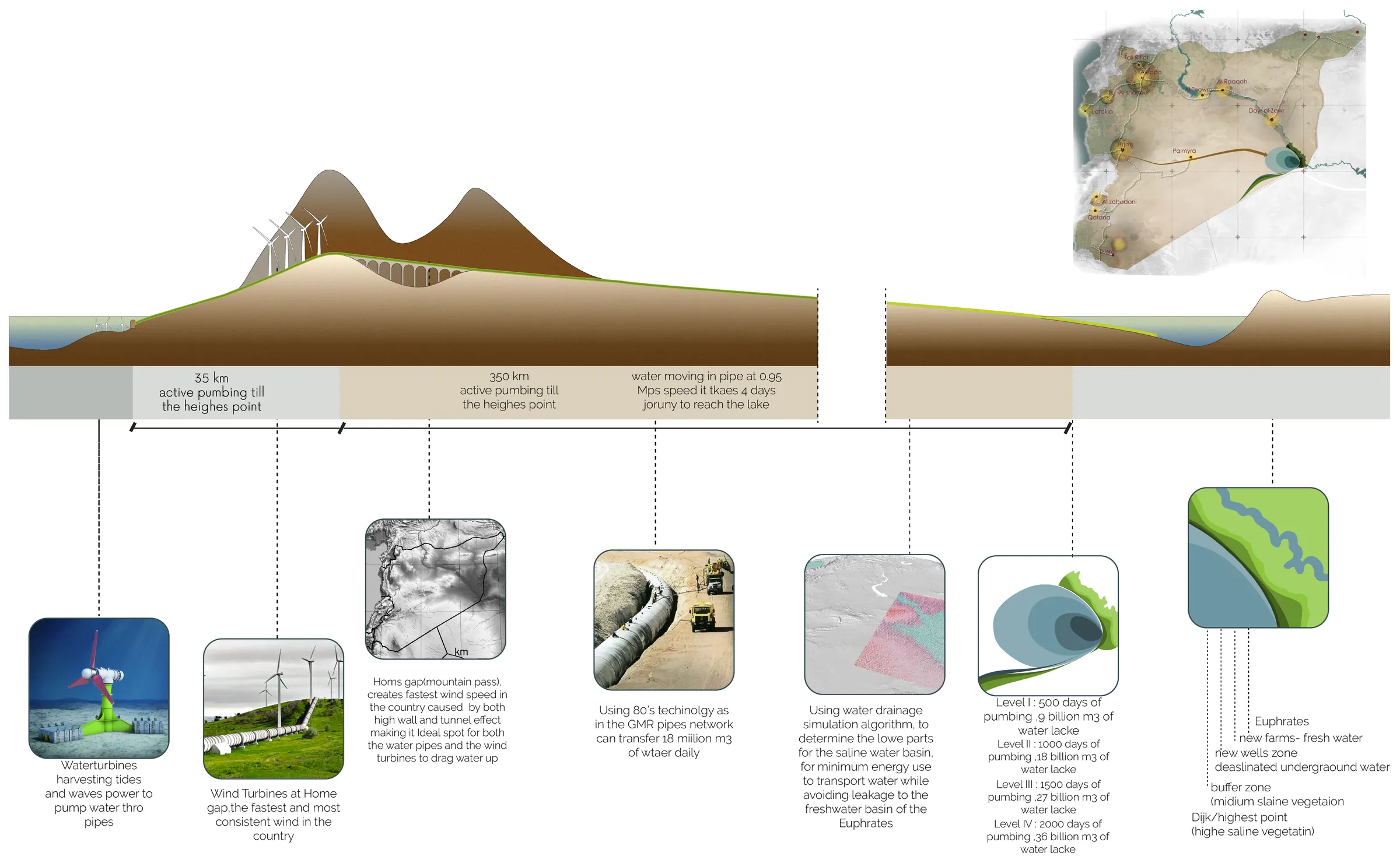
A drainage simulator was used to find the right location for a new inland water basin — the position that minimises the energy needed to pump water there, while keeping saline water from leaking into the Euphrates basin.
The cities marked in the analysis have taken heavy damage in the conflict and are left with thousands of tons of unrecyclable concrete rubble. The existing railway network can carry that rubble to the chosen location, where it becomes the core of the dike that holds the basin.
Pumped by wind, not oil
Seawater is pumped from the Mediterranean into the desert along a short route through the Homs mountain gap. The gap is chosen for its wind: turbines there drive the pumps, which makes the transport of the water independent of fossil fuels from the outset rather than as a later retrofit.
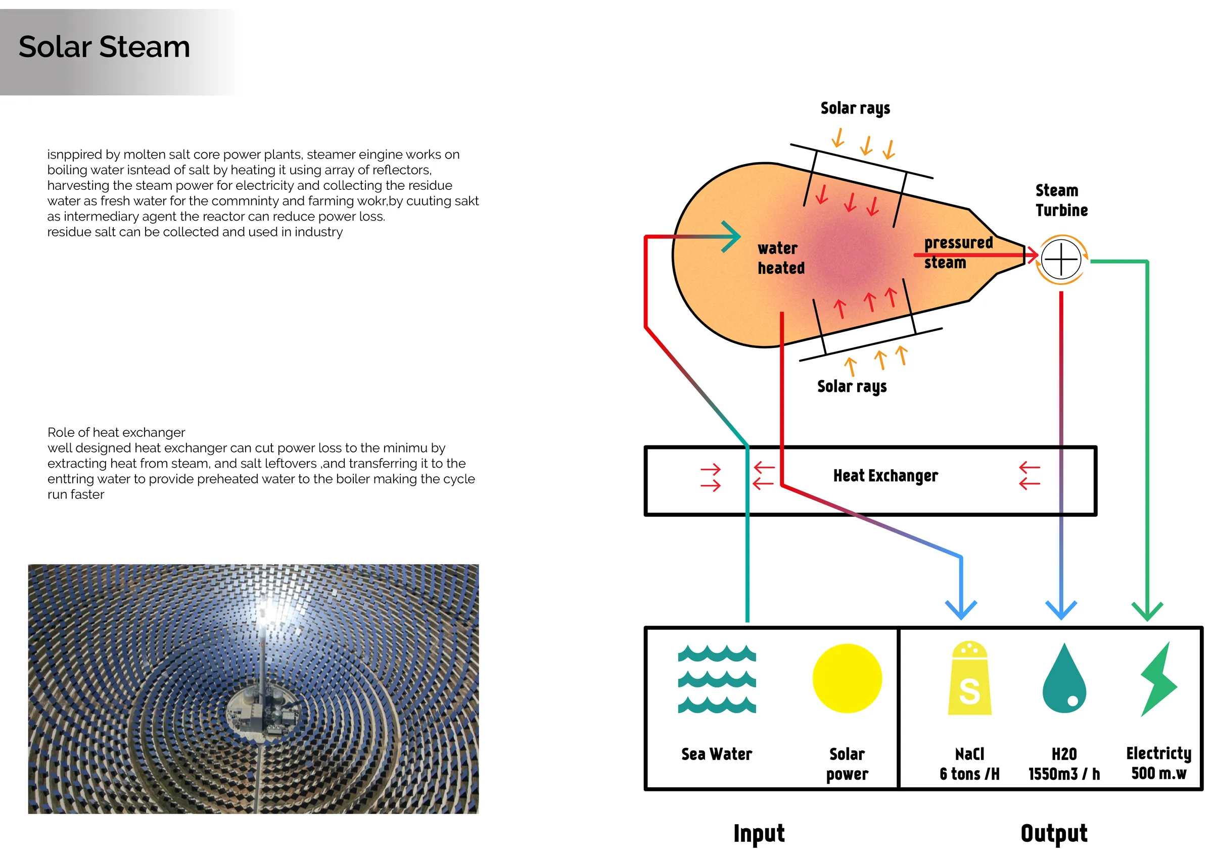
At the basin, a solar farm desalinates the water while generating energy — salt and electricity as parallel products of the same installation.
The body of the dike
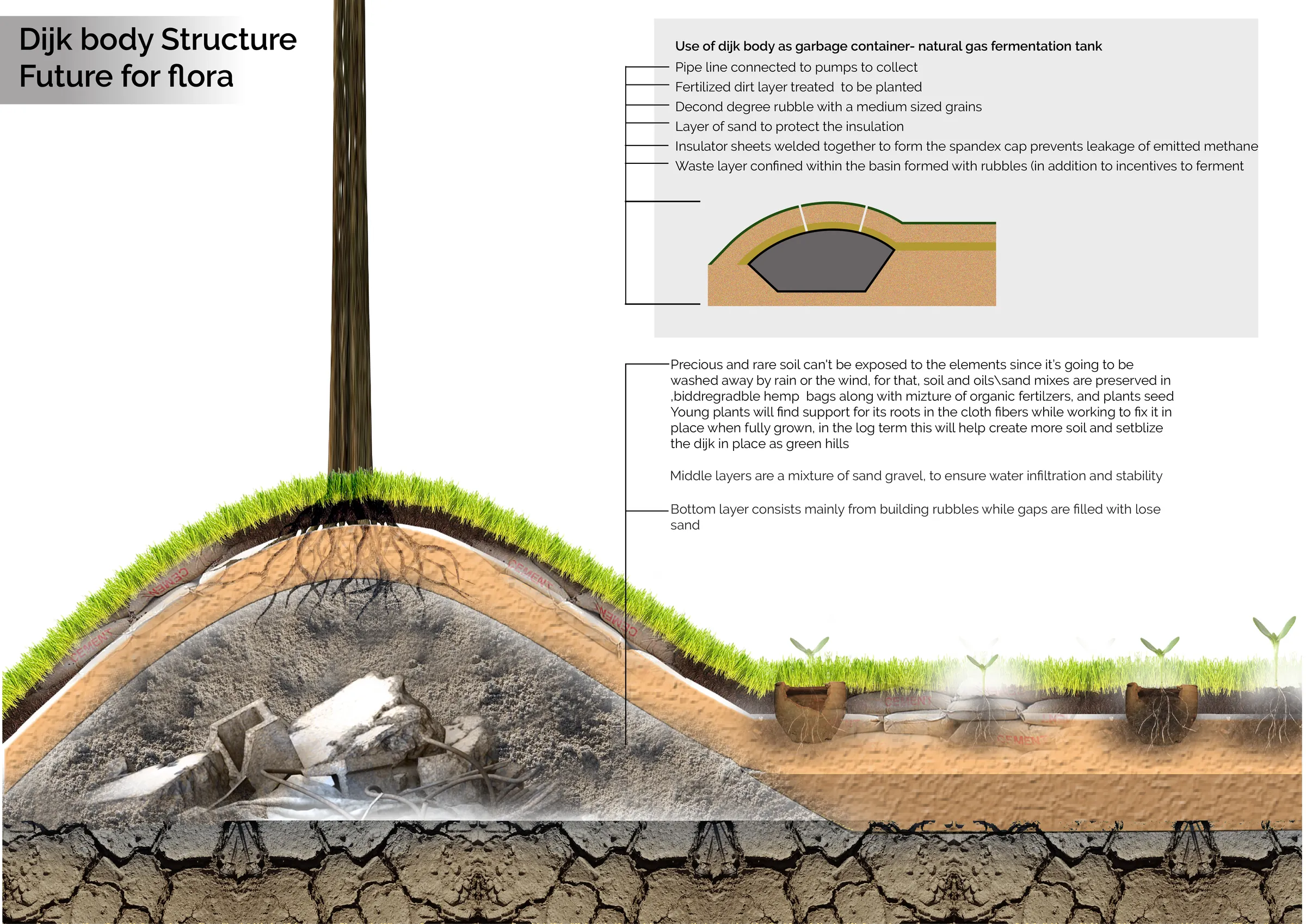
The dike is built in layers: war rubble as the base, sand above it, then a prepared upper stratum that is not simply fill. Waste organic matter, sorted and fermented in cavities inside the dike body, produces methane that is tapped, and leaves behind soil capable of holding vegetation.
A future for flora
Getting anything to grow on a sand dike is the hard part. The section works through the interventions that make it survivable — infiltration, stabilisation, shade, and species selected for the specific stratum they are planted into.
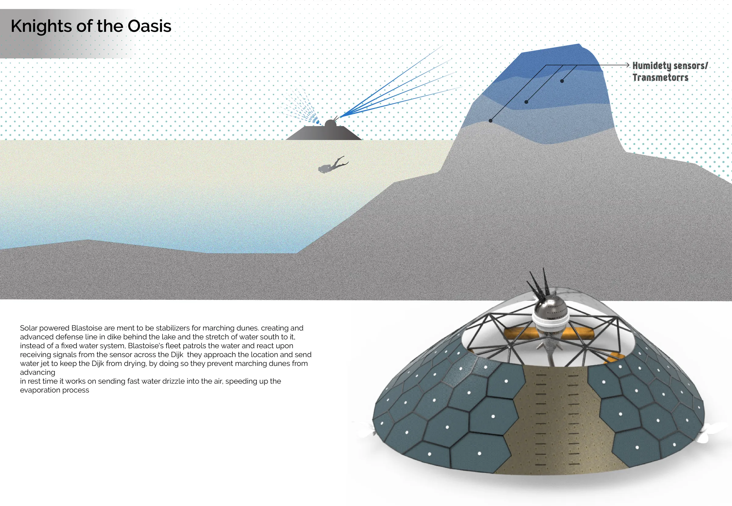
Knights of the oasis
A fleet of autonomous, solar-powered floating drones patrols the basin. Their primary job is to jet-spray the drying sand dike so it does not collapse; the rest of the time they release vapour into the air to bring the local temperature down.
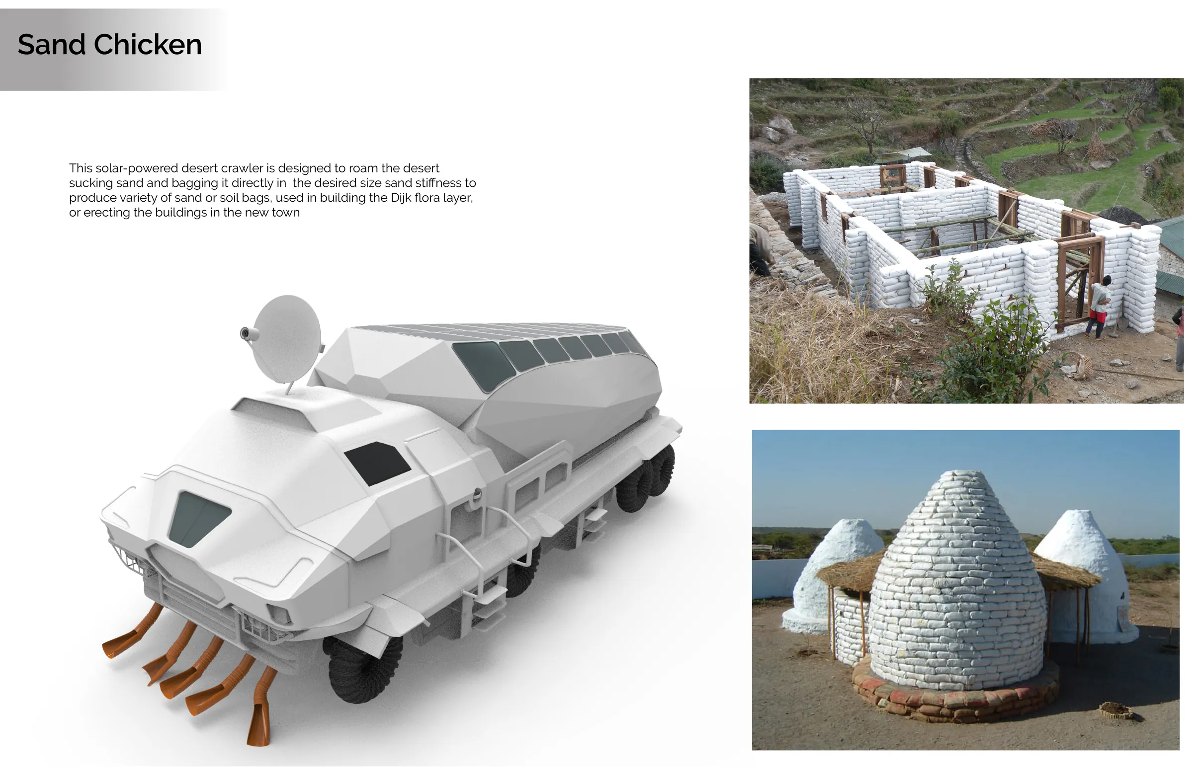
Sand chicken
On land, a solar-powered desert crawler does the equivalent work: sucking sand and bagging it directly, so the bags can be used to build the dike's flora layer or to reinforce buildings in the towns that are being rebuilt. It moves slowly and takes its energy from the thing it is fighting.
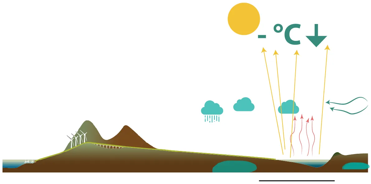
Cooling by evaporation, at regional scale
Taken together, the basin, the vapour, and the planted dike function as one climatic device: a body of water in the desert that lowers local temperature, raises humidity, and starts to change the rainfall pattern over the valley it sits in.
Next project
Boom Open Studio (B.O.S.)